

|
|
|
This extensive tool provides system administrators the ability to design geospatial maps from geocoded backgrounds, translated AutoCAD floor and site plans, .PDF diagrams, and other graphics files. Drag and drop application of system objects like monitored points, portals, controlled points, video views, valves, flows, and area information to backgrounds, the construction of multiple floors for buildings, and the construction of special application layers such as street address layers, telephone number layers, and any other layer that makes sense may be contructed. See the ED0004_DCS_for_ECS_Configuration manual for detailed instructions.
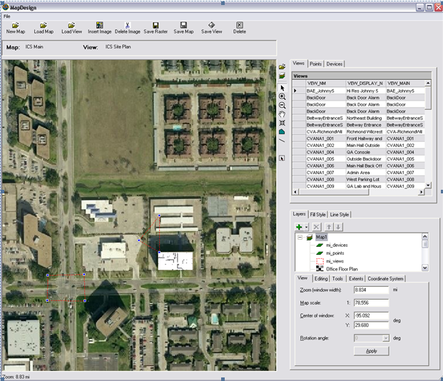
The above shows a design session with a moderate resolution background for ICS' offices in Houston. Notice the white rectangle where floor plans of the roof to the 1st Floor are stacked during design. Devices on each layer are placed so that an event involving those devices will appear on their proper floor.